
GPS LAND SURVEYS
GPS LAND SURVEYS are SURVEYS of LAND and topography that are carried out entirely by radio frequency reference measurements to US and Russian satellites at typical altitudes of 12,000 miles above the earth’s surface. The technology is known as Real Time Kinematic “RTK” and equipment at the survey site consists of just a receiver and a controller (see photograph) GPS surveys do not involve conventional surveying instruments (theodolites, total stations, targets) and are consequently quicker and easier to carry out. They are less costly because they are less labour intensive.
If very fine accuracy is not important, then GPS surveys can be a very useful cost effective alternative to a conventional topographic survey. GPS surveys often achieve accuracy of +/- 10mm in position, and 25mm in height.
Typical applications of GPS surveys:
1. Level and contouring surveys of open land, e.g. for Flood Risk Assessment and Hydraulic Analysis.
2. Surveys and checks of ground features e.g. road layouts, footpaths, railway lines, bridges, watercourses, boundaries, natural features.
3. Volumetric studies of stockpiles of construction materials.
4. Conversion of local grid surveys to OS National Grid and datum.
Limitations of GPS surveys:
5. They do not work well in areas of heavy tree cover or near tall buildings and structures.
6. They are not ideal for tree surveys, without secondary use of conventional instruments.
7. For very large sites, scale factor error may become a consideration if accurate of finely planned positioning of proposed works (e.g. buildings) is needed. GPS surveys are slightly smaller than reality by approximately 40mm in every 100 metres, and are therefore slightly conservative.
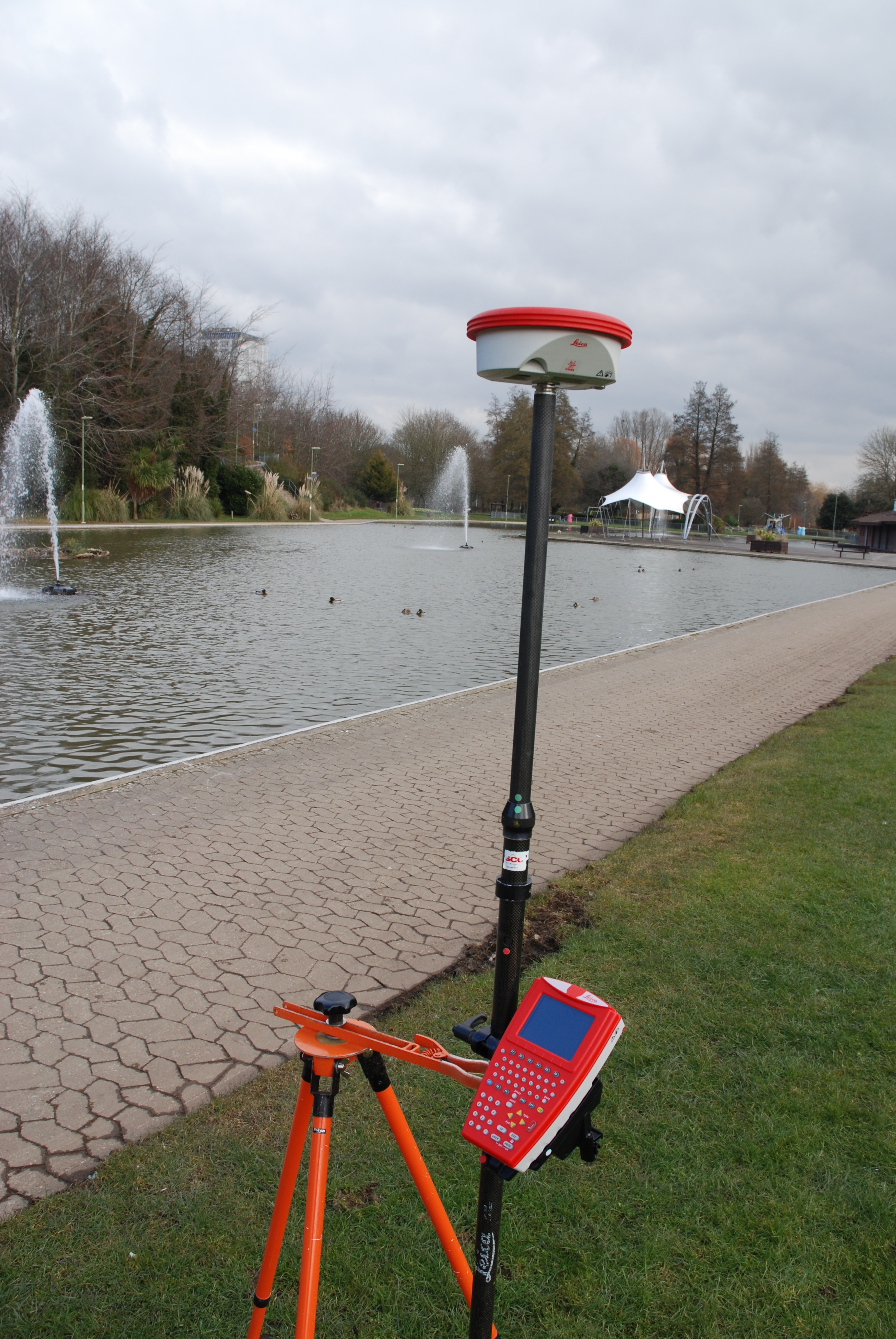
Leica GPS 900 receiver and controller
Trigon Survey & Investigation Ltd own and operate a full inventory of GPS receivers and controllers, and offer a fast response GPS survey service. Please call TODAY on 07864 269005 for a discussion and quotation.